
Tornado Damage, Iowa City,
Iowa
April 13, 2006
New: Map of path of the tornado
See below for links to other photo site and reports.
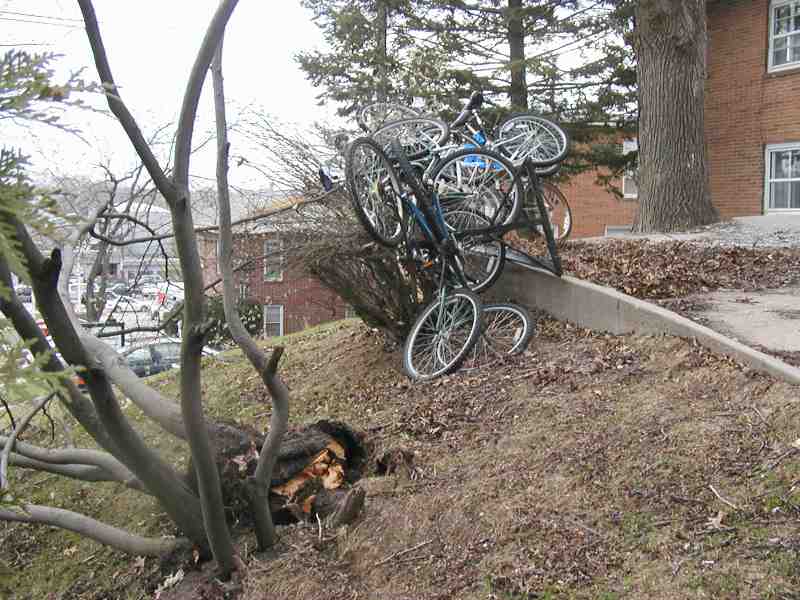
The play house at the child care center on Myrtle (a block from our house) was apparently lifted up over the chain-link fence and dropped by a tree. The bicycles near a student apartment building had been blown into a modern art "bicycle tree." At the foot of the hill, on Riverside, the Kum & Go had come and went.
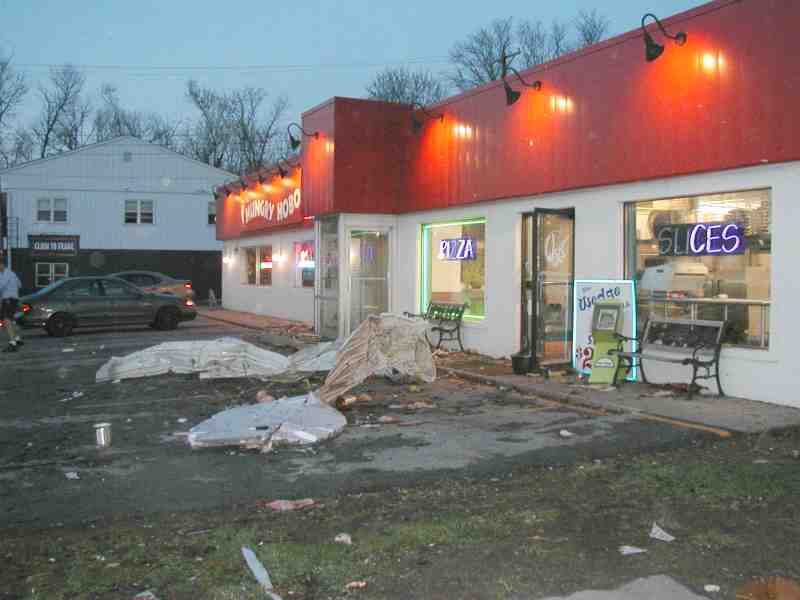
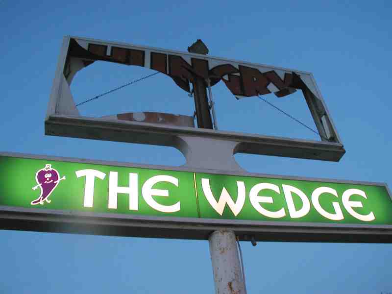
"The Wedge" was still proudly on display -- nothing can stop pizza in a college town -- although the "Hungry Hobo" had decided to move on down the road.
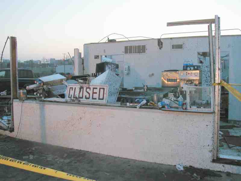
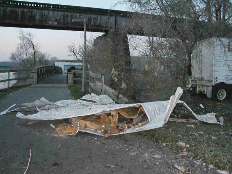
Everyone relates to their local Dairy Queen. This was the item NPR chose to report to the nation regarding our tornado damage. As you can see from the sign, the Dairy Queen is now closed. But a part of it can still be found on the walking and biking path along the Iowa River.
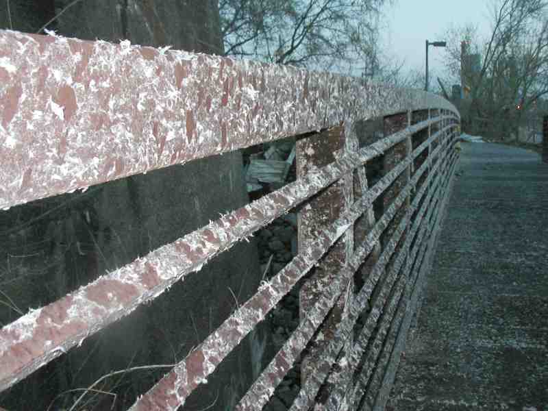
The path will be warmer this winter; as you can see, the combination of insulation floating in the air, rain, and tornado-force winds succeeded in insulating the fence.
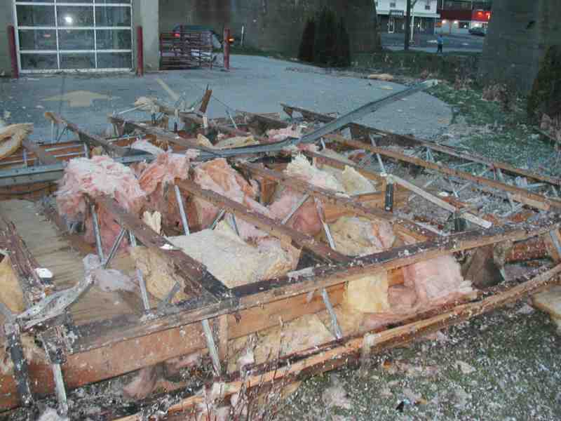
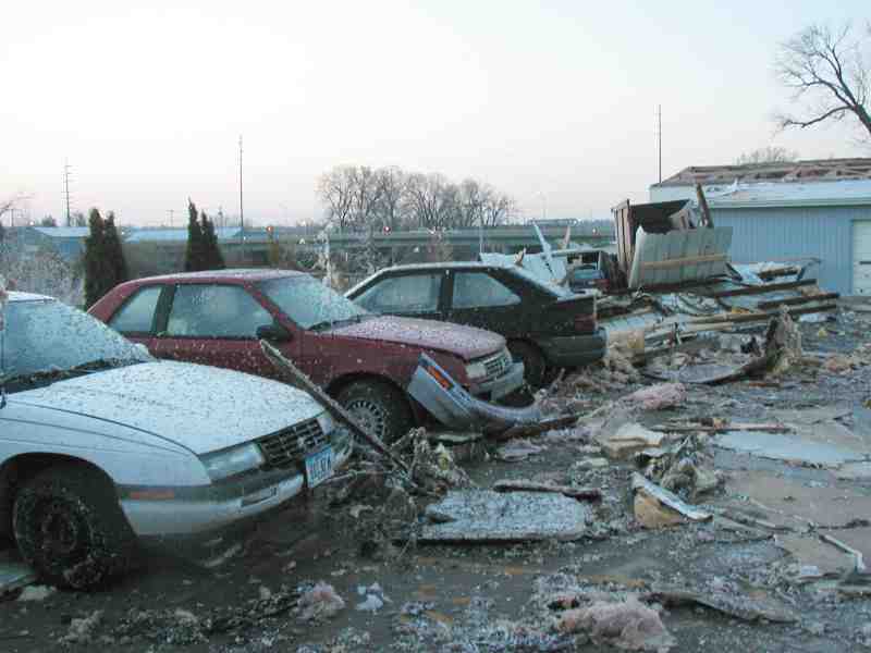
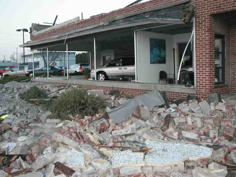
Other businesses along Riverside Drive didn't do all that much better than the Dairy Queen; here's what appears to be a part of a roof from one, as well as more loose material blown against cars. And speaking of cars, a local auto dealer took one of the biggest hits. As you'll recall from the children's story, "The Three Little Pigs," "This little piggy built his house with bricks, and the tornado huffed, and puffed, and blew his brick front down."
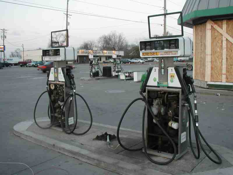
Making a political statement about oil company profits as the tornado rounded the corner at Riverside and Benton, it took out a couple of gas pumps, and the glass in the Sinclair station.
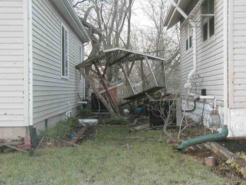
On up Benton a couple of neighbors now share a gazebo.
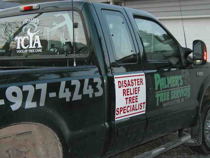
Fortunately for those with trees down some enterprising entrepreneur was able to come up with a sign on short notice that qualified him as a "Disaster Relief Tree Specialist."
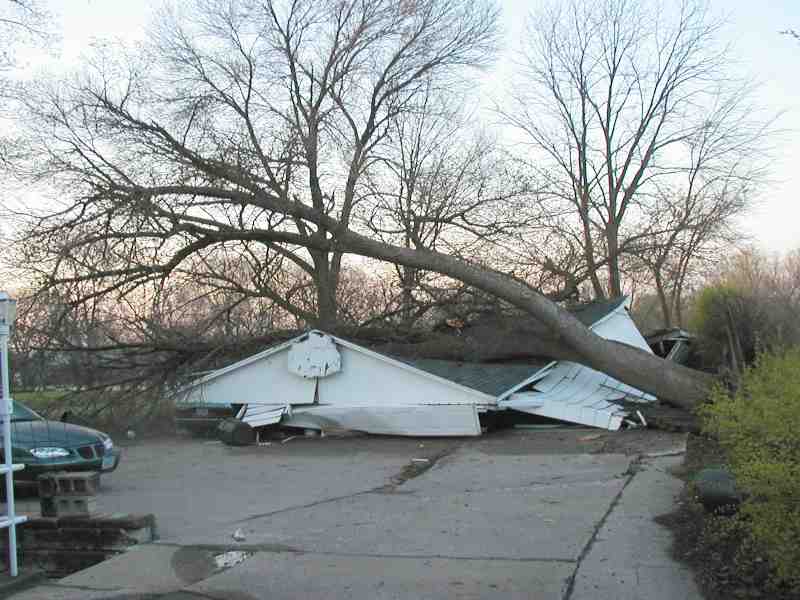
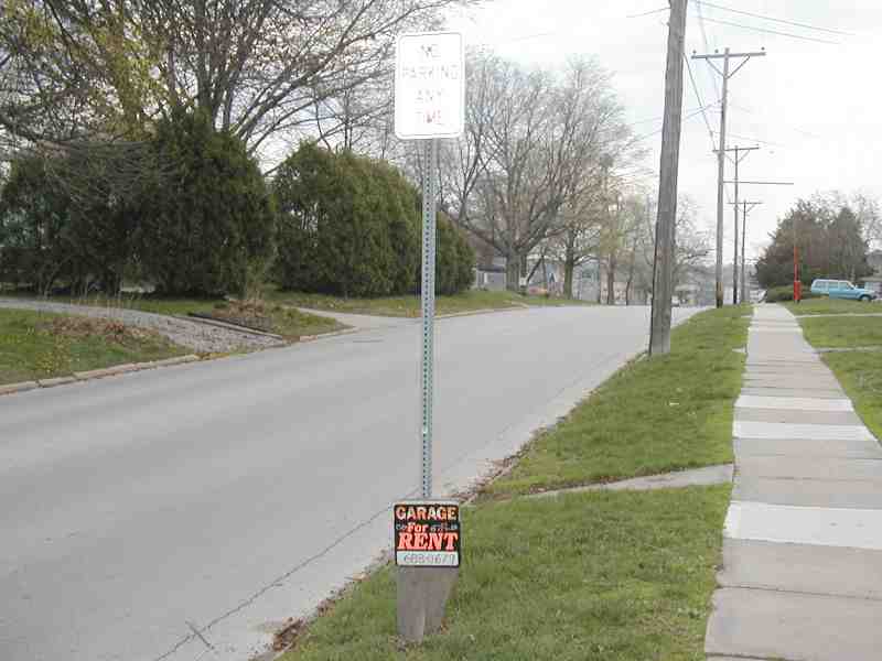
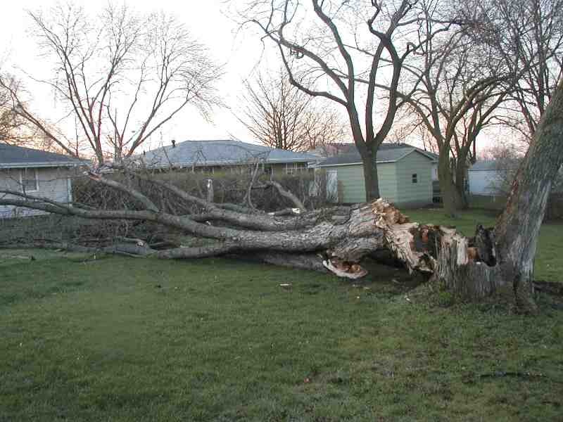
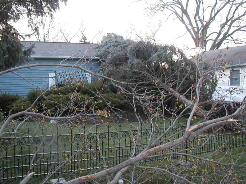
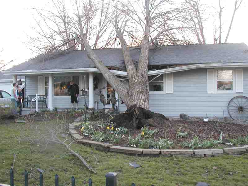
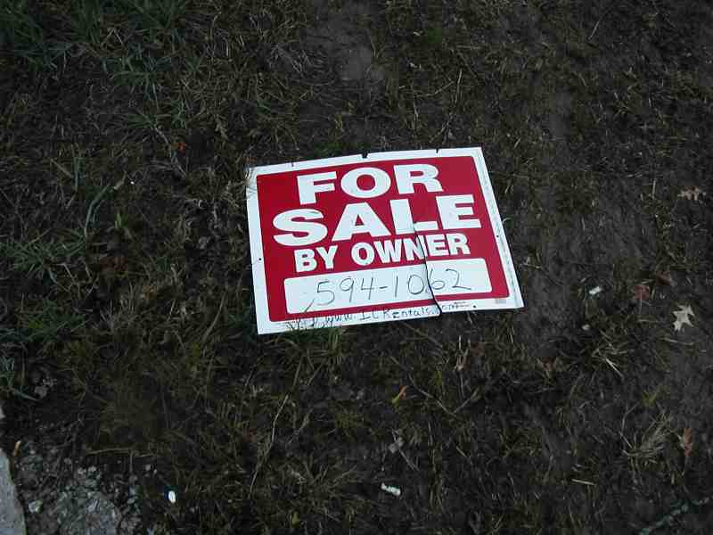
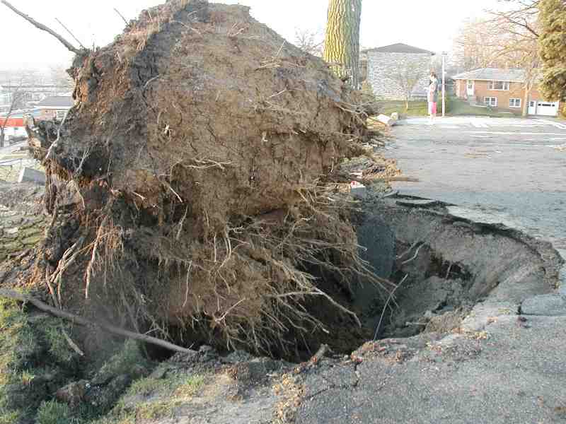
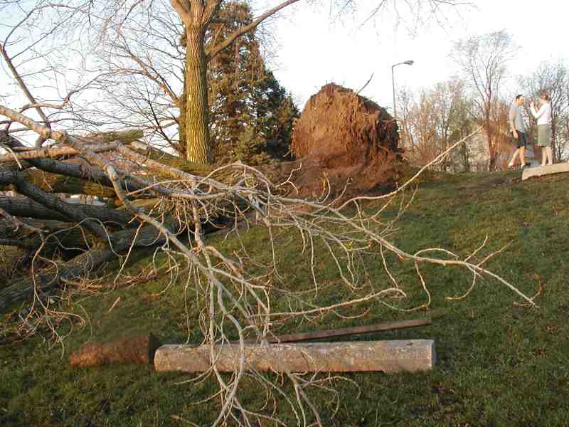
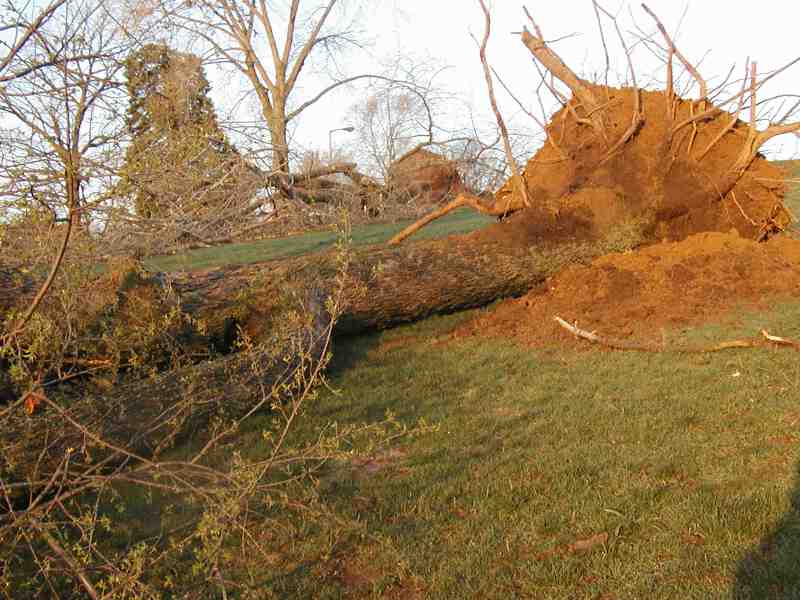
There were a number of fallen trees: along Benton, across a garage on Myrtle (at this point the "No Parking" sign more to the point than the "Garage for Rent" sign), and the lot to the south of it, one house on Olive, another house on Olive, neither of them for sale -- nor is whatever house this sign once identified. One tree was uprooted right out of the south end of the Myrtle Street Parking Lot. Here's another, from that hill, along with a very substantial concrete post, or parking guard, and another shot of both of them.
Given the damaged caused by the five or six tornados that hit Iowa City, and others around eastern Iowa (see the "Sources for Photos and Reports," below) -- not to mention the natural disasters elswere in the country and world -- we are grateful that so few persons sustained even minor injuries. (One death near Muscatine was attributed to the tornado.) Even the property damage was much less than it well could have been in the neighborhood.
So why does this page and its photos focus on the neighborhood? Because there is no shortage of dramatic photos of damage elsewhere, and no need to supplement those professional photos with my amateur efforts. And because one of the purposes of this page was to create a site to which we could send friends from around the country who were emailing: "Are you OK?"
Personally, our family was very lucky. I guess it just wasn't our turn. There was serious damage one block from our house and even more serious damage two blocks away.
Mary, Jason, Alec and I went to the basement, watched the television reports of the approaching tornado (there was tornado activity in at least four eastern Iowa locations being tracked by KCRG-TV9), until the power went off and stayed off. We then listened in the dark to a crank-up radio (KCJJ) -- and to the approaching tornado, with its sounds so many associate with a railroad train roaring through the front yard, as it passed over.
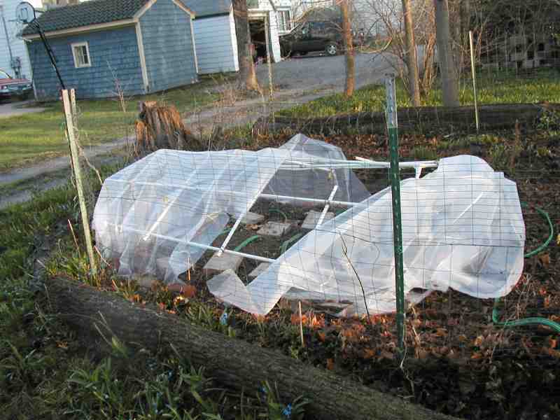
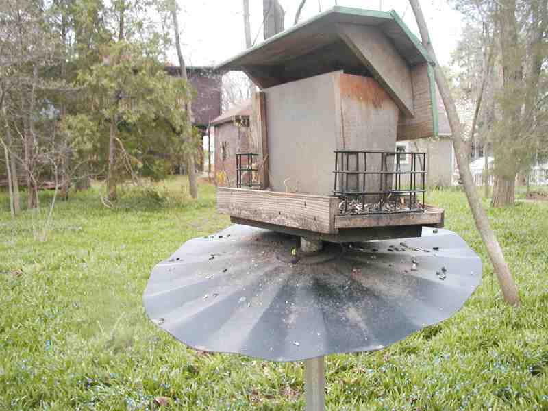
When I went out the next morning to survey our own property damage it was obvious we had really been spared. The 65-foot ham radio tower was standing, with the antenna still pointing in the same direction. In fact, the only changes were that the plastic over the cold frame in our garden had been moved slightly, and the roof over the bird feeder had assumed a jaunty angle. The squirrel nest in the top of the maple tree was, of course, still in good shape; having already braved torrential rains, snow, sleet, and wind storms what's a little tornado to a squirrel?
By the time I finished my morning walk of the neighborhood, and was ready to return home, the sun had come up, and the words to "Tomorrow," from "Annie," were running through my mind.
Some of the best textual and photo coverage can be found on the Web sites of the local papers: the Iowa City Press-Citizen, http://www.press-citizen.com, The Gazette, http://www.gazetteonline.com (subscription required), and The Daily Iowan, http://www.dailyiowan.com. See also KCRG-TV9's reporting at http://www.kcrg.com, and the Des Moines Register, http://www.dmregister.com.
There is even a reference
in Wikipedia, the free, online encyclopedia, at https://en.wikipedia.org/wiki/Iowa_City,_Iowa#2006_tornadoes.
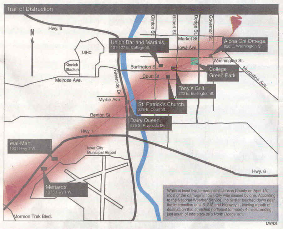
The map gives a good sense of the path of the tornado through town. (It continued on to the north and east, beyond the mapped area, in less of a straight line, continuing to damage homes in that part of town.)
It may take you a moment to get oriented to the map. The dark line in the lower left corner is State Highway 1. The blue is, of course, the Iowa River. The Iowa City Airport is obvious, and the UIHC (hospital) and football stadium (Kinnick) are noted on the west side. You'll see how its path hit the streets I walked and photographed: Benton, then Riverside, Olive and Myrtle. If you know where we live you'll see how close we came.
It also shows you the path it took through town, with St. Patrick's Church, the homes on Iowa Avenue, College Green Park, and so forth.
Click here for the map, copyright by the Daily Iowan, and published April 17, 2006, p. C1.